Back هاركما Arabic Harkema Catalan Harkema CEB Harkema German Harkema Spanish هارکما Persian Harkema French De Harkema FRR De Harkema Frisian Harkema Dutch
Harkema
De Harkema Opeinde | |
|---|---|
Village | |
 Reformed church | |
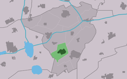
 Location in Achtkarspelen municipality | |
| Coordinates: 53°11′N 6°8′E / 53.183°N 6.133°E | |
| Country | |
| Province | |
| Municipality | |
| Area | |
| • Total | 6.53 km2 (2.52 sq mi) |
| Elevation | 2 m (7 ft) |
| Population (2021)[1] | |
| • Total | 4,295 |
| • Density | 660/km2 (1,700/sq mi) |
| Postal code | 9281[1] |
| Dialing code | 0512 |
Harkema (West Frisian: De Harkema) is a village in the municipality of Achtkarspelen, Friesland province, the Netherlands.
Harkema is in the eastern part of Friesland, 9 km north of Drachten. It was used to be known as Harkema-Opeinde and as of January 2017, the village had a population of 4,295.[3]
- ^ a b c "Kerncijfers wijken en buurten 2021". Central Bureau of Statistics. Retrieved 29 March 2022.
two entries
- ^ "Postcodetool for 9281HA". Actueel Hoogtebestand Nederland (in Dutch). Het Waterschapshuis. Retrieved 29 March 2022.
- ^ Villages Archived 2017-04-22 at the Wayback Machine - Achtkarspelen (in Dutch)


