Back কভিনহেরাড BPY Kvinnherad Catalan Kvinnherad CEB Kvinnherad Danish Kvinnherad German Kvinnherad Esperanto Kvinnherad Spanish Kvinnherad Basque Kvinnherad Finnish Kvinnherad French
Kvinnherad Municipality
Kvinnherad kommune | |
|---|---|
| Kvinnherred herred[1] (historic name) Quindherred herred (historic name) | |
 View of the Husnes area | |
|
| |
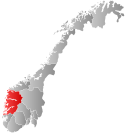
 Vestland within Norway | |
 Kvinnherad within Vestland | |
| Coordinates: 59°55′41″N 06°02′13″E / 59.92806°N 6.03694°E | |
| Country | Norway |
| County | Vestland |
| District | Sunnhordland |
| Established | 1 Jan 1838 |
| • Created as | Formannskapsdistrikt |
| Administrative centre | Rosendal |
| Government | |
| • Mayor (2023) | Vegard Bjørnevik (H) |
| Area | |
| • Total | 1,090.75 km2 (421.14 sq mi) |
| • Land | 1,042.67 km2 (402.58 sq mi) |
| • Water | 48.08 km2 (18.56 sq mi) 4.4% |
| • Rank | #104 in Norway |
| Population (2023) | |
| • Total | 13,058 |
| • Rank | #93 in Norway |
| • Density | 12.5/km2 (32/sq mi) |
| • Change (10 years) | |
| Demonym | Kvinnhering[2] |
| Official language | |
| • Norwegian form | Nynorsk |
| Time zone | UTC+01:00 (CET) |
| • Summer (DST) | UTC+02:00 (CEST) |
| ISO 3166 code | NO-4617[4] |
| Website | Official website |
Kvinnherad is a municipality in Vestland county, Norway. It is located in the traditional district of Sunnhordland, along the Hardangerfjorden. The municipality was the 5th in size in former Hordaland county.[5]
The administrative centre of the municipality is the village of Rosendal. The largest village is Husnes, with about 6,000 people living in or near the village. Other villages include Ænes, Åkra, Dimmelsvik, Eidsvik, Hatlestrand, Herøysund, Høylandsbygd, Ølve, Sæbøvik, Sundal, Sunde, Uskedal, and Valen.
The 1,091-square-kilometre (421 sq mi) municipality is the 104th largest by area out of the 356 municipalities in Norway. Kvinnherad is the 93rd most populous municipality in Norway with a population of 13,058. The municipality's population density is 12.5 inhabitants per square kilometre (32/sq mi) and its population has decreased by 1.9% over the previous 10-year period.[6][7]
In the southern part of Kvinnherad you will find the typical fjord landscape of western Norway. The areas of Mauranger and Rosendal are said to have about the most beautiful fjord landscape of Hardanger as a whole: narrow fjords, wild water-falls, and the nearby Folgefonna, the third biggest glacier in Norway.[5]
- ^ Cite error: The named reference
NLFwas invoked but never defined (see the help page). - ^ "Navn på steder og personer: Innbyggjarnamn" (in Norwegian). Språkrådet.
- ^ "Forskrift om målvedtak i kommunar og fylkeskommunar" (in Norwegian). Lovdata.no.
- ^ Bolstad, Erik; Thorsnæs, Geir, eds. (26 January 2023). "Kommunenummer". Store norske leksikon (in Norwegian). Kunnskapsforlaget.
- ^ a b Store norske leksikon. "Kvinnherad" (in Norwegian). Retrieved 30 March 2015.
- ^ Statistisk sentralbyrå. "Table: 06913: Population 1 January and population changes during the calendar year (M)" (in Norwegian).
- ^ Statistisk sentralbyrå. "09280: Area of land and fresh water (km²) (M)" (in Norwegian).

