Back Maumturk Mountains CEB Maumturks Spanish Maumturks French Sléibhte Mhám Toirc Irish Maumturks Italian Maumturko kalnai Lithuanian Maumturkfjella NN Maumturks NB Maumturk Mountains Swedish
| Maumturks (Maamturks) | |
|---|---|
| Irish: Sléibhte Mhám Toirc | |
 Maumturk Mountains: looking south from Letterbreckaun towards Knocknahillion and Binn idir an dá Log. | |
| Highest point | |
| Peak | Binn idir an dá Log |
| Elevation | 702 m (2,303 ft) |
| Coordinates | 53°29′N 9°36′W / 53.48°N 9.60°W |
| Dimensions | |
| Length | 25 km (16 mi) North West to South East |
| Naming | |
| English translation | pass of the boar |
| Language of name | Irish language |
| Geography | |
| Location | Connemara, County Galway, Ireland |
| Country | Republic of Ireland |
| Provinces of Ireland | Connacht |
| Geology | |
| Mountain type | Pale quartzites, grits, graphitic top |
| Climbing | |
| Normal route | "Maamturks Challenge"[a][1] |
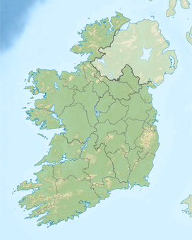
The Maumturks or Maamturks (Irish: Sléibhte Mhám Toirc; mountains of the boar's pass)[b] is a mountain range in Connemara,[c] County Galway, in the west of Ireland. It is a long, broadly-straight range, consisting of weathered quartzite peaks in its central section. The Maumturks lie east of the Twelve Bens, on the other side of Lough Inagh and the Inagh Valley (a Western Way route).
Cite error: There are <ref group=lower-alpha> tags or {{efn}} templates on this page, but the references will not show without a {{reflist|group=lower-alpha}} template or {{notelist}} template (see the help page).
- ^ Cite error: The named reference
UCGwas invoked but never defined (see the help page). - ^ Paul Tempan (February 2012). "Irish Hill and Mountain Names" (PDF). MountainViews.ie.
