Back Newtonmore CEB Newtonmore Welsh Newtonmore German Newtonmore Spanish Newtonmore Basque نیوتونمور Persian Baile Ùr an t-Slèibh Irish Baile Ùr an t-Slèibh Scots/Gaelic Newtonmore Italian Newtonmore Dutch
This article needs additional citations for verification. (April 2022) |
Newtonmore
| |
|---|---|
 Main Street, Newtonmore. In the distance are the Monadhliath mountains. | |
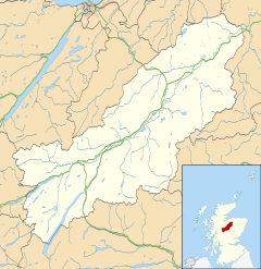
Location within the Badenoch and Strathspey area | |
| Population | 1,120 (2020)[1] |
| OS grid reference | NN715995 |
| • Edinburgh | 85 mi (137 km) |
| • London | 416 mi (669 km) |
| Council area | |
| Country | Scotland |
| Sovereign state | United Kingdom |
| Post town | NEWTONMORE |
| Postcode district | PH20 |
| Dialling code | 01540 |
| Police | Scotland |
| Fire | Scottish |
| Ambulance | Scottish |
| UK Parliament | |
| Scottish Parliament | |
Newtonmore (Scottish Gaelic: Baile Ùr an t-Slèibh [ˈpˠalʲ uːɾˠ ən̪ˠ ˈt̪ʰlʲeːv]) is a village of approximately 1100 inhabitants in Badenoch, within the Highland council area of Scotland. The village is only a few miles from a location that is claimed to be the exact geographical centre of Scotland.
Newtonmore is located within the Cairngorms National Park, approximately 3 miles (5 km) southwest of Kingussie and 15 miles (24 km) southwest of Aviemore. It is on the northeastern bank of the River Spey, between the River Calder and the Allt Lairaidh, at an altitude of approximately 250 metres (820 ft).[2]
- ^ "Mid-2020 Population Estimates for Settlements and Localities in Scotland". National Records of Scotland. 31 March 2022. Retrieved 31 March 2022.
- ^ OS Explorer OL56 Badenoch & Upper Strathspey (Map). Southampton, UK: Ordnance Survey. 2015.
