Back Taxat-Senat AST Taksa-Sena Azerbaijani Taxat-Senat BUG Tatzac e Senac Catalan Такса-Сена CE Taxat-Senat CEB Taxat-Senat German Taxat-Senat DIQ Taxat-Senat Spanish Taxat-Senat Basque
Taxat-Senat | |
|---|---|
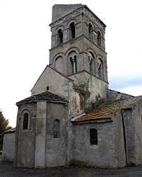
 The church in Senat | |
| Coordinates: 46°12′06″N 3°08′20″E / 46.2017°N 3.1389°E | |
| Country | France |
| Region | Auvergne-Rhône-Alpes |
| Department | Allier |
| Arrondissement | Moulins |
| Canton | Gannat |
| Intercommunality | Saint-Pourçain Sioule Limagne |
| Government | |
| • Mayor (2020–2026) | Jean-Philippe Guittard[1] |
| Area 1 | 13.62 km2 (5.26 sq mi) |
| Population (2021)[2] | 200 |
| • Density | 15/km2 (38/sq mi) |
| Time zone | UTC+01:00 (CET) |
| • Summer (DST) | UTC+02:00 (CEST) |
| INSEE/Postal code | 03278 /03140 |
| Elevation | 267–406 m (876–1,332 ft) (avg. 273 m or 896 ft) |
| 1 French Land Register data, which excludes lakes, ponds, glaciers > 1 km2 (0.386 sq mi or 247 acres) and river estuaries. | |
Taxat-Senat is a commune in the Allier department in Auvergne-Rhône-Alpes in central France. It is located 16.5 kilometres (10.3 mi) northwest of Gannat along the D223 road, northwest of Charroux, southwest of Chezelle, west of Ussel-d'Allier and northeast of Bellenaves and Naves.[3][4]
- ^ "Répertoire national des élus: les maires" (in French). data.gouv.fr, Plateforme ouverte des données publiques françaises. 13 September 2022.
- ^ "Populations légales 2021" (in French). The National Institute of Statistics and Economic Studies. 28 December 2023.
- ^ Fanaud, Lucien (2005). Voies romaines et Vieux Chemins en Bourbonnais. Editions de Borée. p. 231. ISBN 978-2-84494-006-3. Retrieved 30 May 2012.
- ^ Maps (Map). Google Maps.


