| Teun | ||
|---|---|---|
 | ||
| Gewässer | Bandasee | |
| Inselgruppe | Damar-Inseln | |
| Geographische Lage | 6° 58′ 15″ S, 129° 8′ 41″ O | |
|
| ||
| Länge | 4,4 km | |
| Breite | 4,3 km | |
| Fläche | 14,18 km² | |
| Höchste Erhebung | Serawerna 655 m | |
| Einwohner | 1612 (2010) 114 Einw./km² | |
| Hauptort | Isu | |
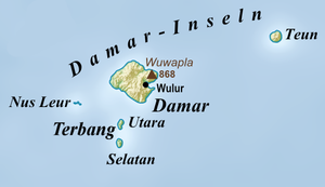
Teun (indonesisch Pulau Teun, auch Teon) ist eine der indonesischen Barat-Daya-Inseln in der Bandasee.

