Paghimo ni bot Lsjbot. |
| Kuala Serey | |
| Suba | |
| Nasod | |
|---|---|
| Lalawigan | Sulawesi Utara |
| Gitas-on | 336 m (1,102 ft) |
| Tiganos | 1°23′21″N 124°55′16″E / 1.3893°N 124.921°E |
| Timezone | CIT (UTC+8) |
| GeoNames | 6755648 |
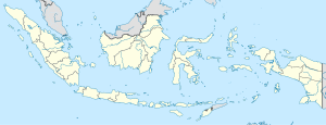
Suba ang Kuala Serey sa Indonesya.[1] Nahimutang ni sa lalawigan sa Sulawesi Utara, sa sidlakang bahin sa nasod, 2,200 km sa sidlakan sa Jakarta ang ulohan sa nasod.
- ↑ Cite error: Invalid
<ref>tag; no text was provided for refs namedgn6755648

