Back Awashrivier Afrikaans አዋሽ ወንዝ Amharic نهر أواش Arabic Avaş çayı Azerbaijani Аваш Byelorussian Аваш (река) Bulgarian Riu Awash Catalan Āwash Wenz CEB Awaš (řeka) Czech Awash Danish
| Awash | ||
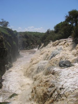
 Awash-Wasserfälle | ||
| Daten | ||
| Lage | ||
| Flusssystem | Awash | |
| Quelle | rund 3 km östlich von Addis Alem 9° 2′ 33″ N, 38° 26′ 33″ O | |
| Quellhöhe | etwa 2600 m | |
| Mündung | bei Arissa in den Abbe-SeeKoordinaten: 11° 11′ 10″ N, 41° 42′ 28″ O 11° 11′ 10″ N, 41° 42′ 28″ O | |
| Mündungshöhe | 240 m | |
| Höhenunterschied | etwa 2360 m | |
| Sohlgefälle | etwa 2 ‰ | |
| Länge | 1200 km[1] | |
| Einzugsgebiet | 110.000 km²[1] | |
| Abfluss am Pegel Hombole[2][3] AEo: 7656 km² |
NNQ (05 März 2001) MNQ 1990–2009 MQ 1990–2009 Mq 1990–2009 MHQ 1990–2009 HHQ (20 Aug. 1996) |
35 l/s 4,13 m³/s 43,5 m³/s 5,7 l/(s km²) 220 m³/s 803 m³/s |
| Mittelstädte | Asaita | |
| Kleinstädte | Awash, Gewane | |
 Einzugsgebiet des Awash | ||
Der Awash (amharisch አዋሽ ወንዝ awaš wänz) ist ein Fluss im Norden Äthiopiens.
- ↑ a b Improving Management of Livestock in Awash River Livestock in Awash River Basin: A Challenge to Basin: A Challenge to Ethiopia
- ↑ Hydrosat, Uni Stuttgart, Abflussmengen Pegel Hombole
- ↑ Flood Hazard Assessment and Mapping of Flood Inundation Area of the Awash River Basin in Ethiopia using GIS and HEC-GeoRAS/HEC-RAS Model