Back Hammond, Indiana Afrikaans هاموند Arabic هاموند (ليك) ARZ هموند، ایندیانا AZB Хаманд (Індыяна) Byelorussian Hammond (Indiana) Catalan Гаммонд (Индиана) CE Hammond (lungsod sa Tinipong Bansa, Indiana) CEB Hammond, Indiana Welsh Hammond DAG
| Hammond | ||
|---|---|---|
 | ||
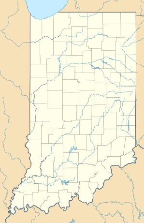
| Lage in Indiana | ||
|
| ||
| Basisdaten | ||
| Gründung: | 1884 | |
| Staat: | Vereinigte Staaten | |
| Bundesstaat: | Indiana | |
| County: | Lake County | |
| Koordinaten: | 41° 37′ N, 87° 30′ W | |
| Zeitzone: | Central (UTC−6/−5) | |
| Einwohner: – Metropolregion: |
77.879 (Stand: 2020) 9.572.572 (Stand: 2010) | |
| Haushalte: | 28.836 (Stand: 2020) | |
| Fläche: | 64,3 km² (ca. 25 mi²) davon 59,3 km² (ca. 23 mi²) Land | |
| Bevölkerungsdichte: | 1.313 Einwohner je km² | |
| Höhe: | 186 m | |
| Vorwahl: | +1 219 | |
| FIPS: | 18-31000 | |
| GNIS-ID: | 0435658 | |
| Website: | www.gohammond.com | |
| Bürgermeister: | Thomas M McDermott Jr. | |
Hammond ist eine City im Lake County des US-Bundesstaates Indiana mit 77.879 Einwohnern[1] (2020).
- ↑ U.S. Census Bureau QuickFacts: Hammond city, Indiana. Abgerufen am 18. Februar 2022 (englisch).
