Back Lennoxtown CEB Lennoxtown Welsh Lennoxtown English Lennoxtown Spanish Lennoxtown Basque لنوکستاون Persian Lennoxtown French Baile na Leamhnachd Irish Baile na Leamhnachd Scots/Gaelic Lennoxtown Italian
| Lennoxtown schottisch-gälisch Baile na Leamhnachd | ||
|---|---|---|
 | ||
| Koordinaten | 55° 58′ N, 4° 12′ W | |
|
| ||
| Traditionelle Grafschaft | Stirlingshire | |
| Einwohner | 4094 Zensus 2011 | |
| Verwaltung | ||
| Post town | GLASGOW | |
| Postleitzahlenabschnitt | G66 | |
| Vorwahl | 01360 | |
| Landesteil | Scotland | |
| Council area | East Dunbartonshire | |
| Britisches Parlament | Cumbernauld, Kilsyth and Kirkintilloch East | |
| Schottisches Parlament | Strathkelvin and Bearsden | |
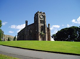
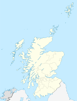
Lennoxtown (gälisch: Baile na Leamhnachd[1]) ist eine Ortschaft in der schottischen Council Area East Dunbartonshire. Sie liegt am Nordrand des Central Belts etwa 13 km nordöstlich von Glasgow und 26 Kilometer westlich von Falkirk am Fuß der Hügelkette Campsie Fells.[2]
- ↑ Verzeichnis gälischer Ausdrücke
- ↑ Lennoxtown (Newton of Campsie). East Dunbartonshire. In: David Munro, Bruce Gittings: Scotland. An Encyclopedia of Places & Landscapes. Collins u. a., Glasgow 2006, ISBN 0-00-472466-6.
