Back Lexington, Virginië Afrikaans كسينغتون Arabic Lexington, Virginia BAR Lexington (Virgínia) Catalan Лексингтон (Виргини) CE Lexington (kapital sa kondado sa Tinipong Bansa, Virginia) CEB Lexington (Virginia) Danish Lexington, Virginia English Lexington (Virginia) Spanish Lexington city konderria (Virginia) Basque
| Lexington | ||
|---|---|---|
| Spitzname: Shrine of the South | ||
 | ||
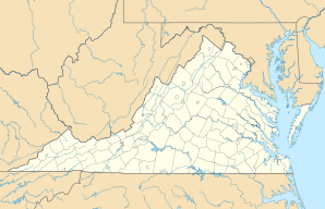
| Lage in Virginia | ||
|
| ||
| Basisdaten | ||
| Gründung: | 1777 | |
| Staat: | Vereinigte Staaten | |
| Bundesstaat: | Virginia | |
| Koordinaten: | 37° 47′ N, 79° 27′ W | |
| Zeitzone: | Eastern (UTC−5/−4) | |
| Einwohner: | 7.320 (Stand: 2020) | |
| Haushalte: | 2.066 (Stand: 2020) | |
| Fläche: | 6,5 km² (ca. 3 mi²) davon 6,5 km² (ca. 3 mi²) Land | |
| Bevölkerungsdichte: | 1.126 Einwohner je km² | |
| Höhe: | 324 m | |
| Postleitzahl: | 24450 | |
| Vorwahl: | +1 540 | |
| FIPS: | 51-45512 | |
| GNIS-ID: | 1498506 | |
| Website: | www.lexingtonva.gov | |
| Bürgermeister: | Frank W. Friedman[1][2][3] | |
Lexington (auch als Shrine of the South[4] bekannt) ist eine Independent city (kreisfreie Stadt) im US-Bundesstaat Virginia. Das U.S. Census Bureau hat bei der Volkszählung 2020 eine Einwohnerzahl von 7.320[5] ermittelt. Die Stadt hat eine Fläche von 6,4 km². Lexington beheimatet das Virginia Military Institute und die Washington and Lee University. Die Stadt ist der County Seat des Rockbridge Countys.
- ↑ www.lexingtonva.gov. (abgerufen am 13. Juni 2022).
- ↑ Maria Rachal: Friedman outlines plans as Lexington’s next mayor. 10. November 2016 (abgerufen am 13. Februar 2023): „On Jan. 1, Frank Friedman will be the new mayor of Lexington“
- ↑ historical.elections.virginia.gov. (abgerufen am 13. Februar 2023).
- ↑ Tompkins, Edmund Pendleton. Rockbridge County, Virginia. An Informal History. Richmond, Virginia: Whittet & Shepperson, 1952. p10
- ↑ Explore Census Data Total Population in Lexington city, Virginia. Abgerufen am 8. Februar 2023.
