Back Loch Lomond Afrikaans لوخ لوموند Arabic بحيره لوتش لوموند ARZ Лох Ломонд Bulgarian Loch Laomainn Breton Loch Lomond Catalan Loch Lomond (lanaw sa Hiniusang Gingharian) CEB Loch Lomond Czech Лох-Ломонд CV Llyn Llumonwy Welsh
| Loch Lomond | ||
|---|---|---|

| ||
| Geographische Lage | Loch Lomond and the Trossachs National Park, Schottland | |
| Zuflüsse | Falloch | |
| Abfluss | Leven → Clyde | |
| Daten | ||
| Koordinaten | 56° 5′ N, 4° 36′ W | |
|
| ||
| Höhe über Meeresspiegel | 7,9 m ASL | |
| Fläche | 71 km² | |
| Länge | 39 km | |
| Breite | 8 km | |
| Volumen | 2,6 km³ | |
| Maximale Tiefe | 190 m | |
| Mittlere Tiefe | 37 m | |
|
Besonderheiten |
größter See Schottlands mit zahlreichen Inseln | |
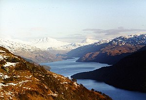
Loch Lomond (Aussprache: britisch ; lokal ; gälisch Loch Laomainn) ist mit 71 km² der nach Fläche größte See Schottlands und Großbritanniens sowie der drittgrößte See des Vereinigten Königreichs. Er liegt im Südwesten der Highlands 23 km nordwestlich von Glasgow in den Council Areas Argyll and Bute, West Dunbartonshire und Stirling. In romantischen Liedern wie The Bonnie Banks o’ Loch Lomond besungen, gilt der See als der schönste Schottlands und ist seit 2002 Teil des Nationalparks Loch Lomond and the Trossachs.
