Back Муонио Bashkir Muonio Catalan Muonio (munisipyo) CEB Muonio (obec) Czech Muonio English Muonio Esperanto Muonio (Laponia) Spanish Muonio vald Estonian Muonio Basque مونیو Persian
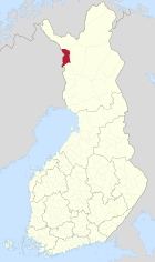
| Wappen | Karte |
|---|---|

|

|
| Basisdaten | |
| Staat: | |
| Landschaft: | Lappland |
| Verwaltungsgemeinschaft: | Fjell-Lappland |
| Geographische Lage | 67° 57′ N, 23° 41′ O |
| Fläche: | 2.037,91 km²[1] |
| davon Landfläche: | 1.903,87 km² |
| davon Binnengewässerfläche: | 134,04 km² |
| Einwohner: | 2.281 (31. Dez. 2022)[2] |
| Bevölkerungsdichte: | 1,2 Ew./km² |
| Gemeindenummer: | 498 |
| Sprache(n): | Finnisch |
| Website: | muonio.fi |
Muonio [] ist eine Gemeinde im finnischen Teil Lapplands. Sie liegt rund 200 km nördlich des Polarkreises.
- ↑ Maanmittauslaitos (finnisches Vermessungsamt): Suomen pinta-alat kunnittain 1. 1. 2010. (PDF; 199 kB)
- ↑ Statistisches Amt Finnland: Tabelle 11ra -- Key figures on population by region, 2022