Back Pampilhosa da Serra AN Pampilhosa da Serra Catalan Пампильоза-да-Серра CE Pampilhosa da Serra (munisipyo) CEB Pampilhosa da Serra English Pampilhosa da Serra Esperanto Pampilhosa da Serra Spanish Pampilhosa da Serra Basque Pampilhosa da Serra French Pampilhosa da Serra Hungarian
| Pampilhosa da Serra | ||||||
|---|---|---|---|---|---|---|
| ||||||
| Basisdaten | ||||||
| Region: | Centro | |||||
| Unterregion: | Região de Coimbra | |||||
| Distrikt: | Coimbra | |||||
| Concelho: | Pampilhosa da Serra | |||||
| Koordinaten: | 40° 3′ N, 7° 57′ W | |||||
| Einwohner: | 1303 (Stand: 19. April 2021)[1] | |||||
| Fläche: | 100,18 km² (Stand: 1. Januar 2010)[2] | |||||
| Bevölkerungsdichte: | 13 Einwohner pro km² | |||||
| Postleitzahl: | 3320 | |||||
| Politik | ||||||
| Bürgermeister: | José Alberto Pacheco Brito Dias (PSD) | |||||
| Adresse der Gemeindeverwaltung: | Junta de Freguesia de Pampilhosa da Serra 3320-229 Pampilhosa da Serra | |||||
| Website: | www.freguesias.pt/freguesia.php?cod=061206 | |||||
| Kreis Pampilhosa da Serra | ||||||
| ||||||
| Einwohner: | 4082 (Stand: 19. April 2021)[3] | |||||
| Fläche: | 396,48 km² (Stand: 1. Januar 2010)[2] | |||||
| Bevölkerungsdichte: | 10 Einwohner pro km² | |||||
| Anzahl der Gemeinden: | 8 | |||||
| Verwaltung | ||||||
| Adresse der Verwaltung: | Câmara Municipal de Pampilhosa da Serra Rua Rangel de Lima 3320-229 Pampilhosa da Serra | |||||
| Website: | www.cm-pampilhosadaserra.pt | |||||
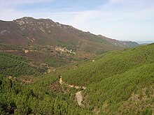
Pampilhosa da Serra ist eine Vila (Kleinstadt) und ein Kreis (Concelho) in Portugal mit 1303 Einwohnern (Stand 19. April 2021).


- ↑ www.ine.pt – Indikator Resident population by Place of residence and Sex; Decennial in der Datenbank des Instituto Nacional de Estatística
- ↑ a b Übersicht über Code-Zuordnungen von Freguesias auf epp.eurostat.ec.europa.eu
- ↑ www.ine.pt – Indikator Resident population by Place of residence and Sex; Decennial in der Datenbank des Instituto Nacional de Estatística


