Back Santa Cruz das Flores Catalan Санта-Круш-даш-Флореш CE Santa Cruz Das Flores (munisipyo) CEB Santa Cruz das Flores English Santa Cruz das Flores Spanish Santa Cruz das Flores French Santa Cruz das Flores Italian 산타크루스다스플로르스 Korean Santa Kruz das Florešas Lithuanian Santa Cruz das Flores Malay
| Santa Cruz das Flores | ||||||
|---|---|---|---|---|---|---|
| ||||||
| Basisdaten | ||||||
| Autonome Region: | Azoren | |||||
| Concelho: | Santa Cruz das Flores | |||||
| Koordinaten: | 39° 27′ N, 31° 7′ W | |||||
| Einwohner: | 1552 (Stand: 19. April 2021)[1] | |||||
| Fläche: | 39,68 km² (Stand: 1. Januar 2010)[2] | |||||
| Bevölkerungsdichte: | 39 Einwohner pro km² | |||||
| Postleitzahl: | 9970-xxx | |||||
| Kreis Santa Cruz das Flores | ||||||
| ||||||
| Einwohner: | 2020 (Stand: 19. April 2021)[3] | |||||
| Fläche: | 70,91 km² (Stand: 1. Januar 2010)[2] | |||||
| Bevölkerungsdichte: | 28 Einwohner pro km² | |||||
| Anzahl der Gemeinden: | 4 | |||||
| Verwaltung | ||||||
| Adresse der Verwaltung: | Câmara Municipal de Santa Cruz das Flores Rua Senador André de Freitas 13 9970-337 Santa Cruz das Flores | |||||
| Präsident der Câmara Municipal: | José Carlos Pimentel Mendes (PS) | |||||
| Website: | www.cmscflores.pt | |||||
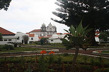
Santa Cruz das Flores () ist die Hauptstadt der portugiesischen Azoreninsel Flores und Sitz eines Kreises (Concelho). Sie ist mit 1552 Einwohnern (Stand 19. April 2021) die bevölkerungsreichste Gemeinde (Freguesia) der Insel und neben Lajes das Flores im Süden der zweite Ort der Insel mit touristischen Einrichtungen.
 |
- ↑ www.ine.pt – Indikator Resident population by Place of residence and Sex; Decennial in der Datenbank des Instituto Nacional de Estatística
- ↑ a b Übersicht über Code-Zuordnungen von Freguesias auf epp.eurostat.ec.europa.eu
- ↑ www.ine.pt – Indikator Resident population by Place of residence and Sex; Decennial in der Datenbank des Instituto Nacional de Estatística


