Back أدل Arabic ادل ARZ ادل، آیووا AZB Adel (Iowa) Catalan Эйдел (Айова) CE Adel (kapital sa kondado sa Tinipong Bansa, Iowa) CEB Adel, Iowa Welsh Adel (Iowa) German Adel (Iowa) Spanish Adel (Iowa) Basque
Adel, Iowa | |
|---|---|
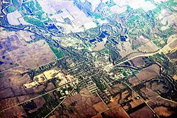
 Aerial view of Adel | |
 Location of Adel, Iowa | |
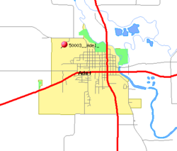
 Detailed map of Adel | |
| Coordinates: 41°36′36″N 94°00′45″W / 41.61000°N 94.01250°W | |
| Country | |
| State | |
| County | Dallas |
| Incorporated | 1847 |
| Government | |
| • Type | Mayor-council government |
| • Mayor | Jim Peters |
| Area | |
| • Total | 5.36 sq mi (13.88 km2) |
| • Land | 5.34 sq mi (13.83 km2) |
| • Water | 0.02 sq mi (0.05 km2) |
| Elevation | 892 ft (272 m) |
| Population (2020) | |
| • Total | 6,153 |
| • Density | 1,152.25/sq mi (444.90/km2) |
| Time zone | UTC-6 (Central (CST)) |
| • Summer (DST) | UTC-5 (CDT) |
| ZIP code | 50003 |
| Area code | 515 |
| FIPS code | 19-00505 |
| GNIS feature ID | 2393882[2] |
| Website | adeliowa.org |
Adel (/ˈeɪdəl/ AY-dəl) is a city in and the county seat of Dallas County, Iowa.[3] It is located along the North Raccoon River. Its population was 6,153 at the time of the 2020 Census.[4]
- ^ "2020 U.S. Gazetteer Files". United States Census Bureau. Retrieved March 16, 2022.
- ^ a b U.S. Geological Survey Geographic Names Information System: Adel, Iowa
- ^ "Find a County". National Association of Counties. Archived from the original on May 31, 2011. Retrieved June 7, 2011.
- ^ "2020 Census State Redistricting Data". census.gov. United states Census Bureau. Retrieved August 12, 2021.
