Back Adelong CEB آدلانگ، نیو ساوت ولز Persian Adelong French Adelong Dutch Adelong Polish Adelong, New South Wales SIMPLE Adelong Swedish
| Adelong New South Wales | |||||||||
|---|---|---|---|---|---|---|---|---|---|
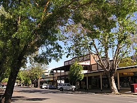
 Main street | |||||||||
| Coordinates | 35°18′S 148°03′E / 35.300°S 148.050°E | ||||||||
| Population | 856 (UCL 2021)[1] | ||||||||
| Established | 1836 | ||||||||
| Postcode(s) | 2729 | ||||||||
| Elevation | 303 m (994 ft) | ||||||||
| Location |
| ||||||||
| LGA(s) | Snowy Valleys Council | ||||||||
| County | Wynyard | ||||||||
| State electorate(s) | Wagga Wagga | ||||||||
| Federal division(s) | Eden-Monaro | ||||||||
| |||||||||
Adelong is a small town in the Riverina region of New South Wales, Australia, on the banks of the Adelong Creek. Adelong sits on the Snowy Mountains Highway and is a part of the Snowy Valleys Council. At the 2016 census, Adelong had an urban population of 943.[3]
- ^ Australian Bureau of Statistics (28 June 2022). "Adelong (urban centre and locality)". Australian Census 2021.
- ^ Travelmate Archived 2007-03-24 at the Wayback Machine
- ^ Australian Bureau of Statistics (27 June 2017). "Adelong (state suburb)". 2016 Census QuickStats. Retrieved 29 June 2017.
