Ain Aata
Ain Ata, 'Ain 'Ata, Ayn Aata | |
|---|---|
Village | |
 | |
| Country | |
| Governorate | Beqaa Governorate |
| District | Rashaya District |
| Area | |
| • Total | 22.40 sq mi (58.02 km2) |
| Elevation | 4,360 ft (1,330 m) |
| Population | |
| • Total | around 4,000 |
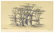
 Cedars, in the hills of Ain Aata (2 June 1860)[1] | |
| Alternative name | Ain Aata, 'Ain 'Ata, Ayn Aata |
|---|---|
| Location | 99 kilometres (62 mi) east of Beirut |
| Region | Rashaya |
| Coordinates | 33°26′11″N 35°46′46″E / 33.436390°N 35.779446°E |
| History | |
| Cultures | Roman |
| Site notes | |
| Public access | Yes |
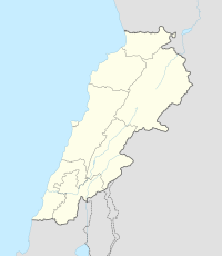
Ain Aata, Ain Ata, 'Ain 'Ata or Ayn Aata is a village and municipality situated southwest of Rashaya, 99 kilometres (62 mi) south-east of Beirut, in the Rashaya District of the Beqaa Governorate in Lebanon.[2]
The name is thought to mean 'gift spring'.[3] There is a remarkably cold spring in the area.[1]

