| Ajanta Range | |
|---|---|
 Part of Ajanta range around Antur fort | |
| Highest point | |
| Elevation | 500–700 m (1,600–2,300 ft) |
| Coordinates | 20°20′N 75°10′E / 20.34°N 75.16°E |
| Geography | |
| Location | Ajanta Range |
| Country | India |
| State | Maharashtra |
| District(s) | Jalgaon, Aurangabad, Buldhana |
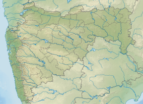
The Ajanta range (Marathi: अजिंठा पर्वतरांगा) is a mountain range in the state of Maharashtra in Central India. The range forms northern wall of the Deccan plateau and acts as a watershed between tributaries of the Godavari and Tapi rivers.[1]
- ^ Hunter, William Wilson (1881). The Imperial Gazetteer of India. London: Trubner & Co. p. 88. ISBN 978-81-7019-101-8. Retrieved 18 November 2023.

