Back Amatholeberge Afrikaans Amathole-Berge German Amatolo (montaro) Esperanto Montagnes d'Amathole French Amathole-Berge LLD 阿馬托拉山脈 Chinese
| Amatola Mountains | |
|---|---|
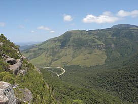
 Auckland Forest in the Amathola Mountains | |
| Highest point | |
| Peak | Gaika's Kop |
| Elevation | 1,963 m (6,440 ft) |
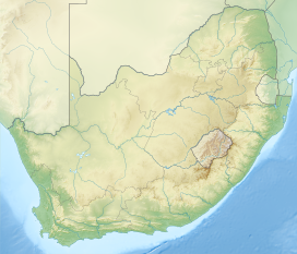
| Coordinates | 32°34′50″S 27°12′30″E / 32.58056°S 27.20833°E |
| Dimensions | |
| Length | 280 km (170 mi) E/W |
| Width | 90 km (56 mi) N/S |
| Geography | |
| Country | South Africa |
| Province | Eastern Cape |
| Geology | |
| Orogeny | Kaapvaal craton |
| Age of rock | Neoarchean to early Paleoproterozoic |
| Type of rock | Bushveld igneous complex, sandstone |
Amatola, Amatole or Amathole are a range of densely forested mountains, situated in the Eastern Cape province of South Africa. The word Amathole means ‘calves’ in Xhosa, and Amathole District Municipality, which lies to the south, is named after these mountains.
