Back Аміранцкія астравы Byelorussian Амирантски острови Bulgarian Inizi Amirante Breton Illes Almirall Catalan Les Amirantes CEB Amiranty Czech Amiranten German Amirantoj Esperanto Islas Amirante Spanish Amirandid Estonian
This article includes a list of references, related reading, or external links, but its sources remain unclear because it lacks inline citations. (February 2010) |
Nickname: Ilhas do Almirante | |
|---|---|
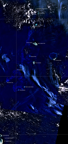
 Satellite Image Map, with neighbouring Alphonse Group in the lower left | |
| Geography | |
| Location | Indian Ocean |
| Coordinates | 04°49′S 53°40′E / 4.817°S 53.667°E |
| Archipelago | Seychelles |
| Adjacent to | Indian Ocean |
| Total islands | 20 |
| Major islands | |
| Area | 11.5 km2 (4.4 sq mi) |
| Highest elevation | 15 m (49 ft) |
| Administration | |
| Group | Outer Islands |
| Sub-Group | Amirante Islands |
| Districts | Outer Islands District |
| Largest settlement | Île Desroches (pop. 40) |
| Demographics | |
| Population | 300 (2014) |
| Pop. density | 26/km2 (67/sq mi) |
| Ethnic groups | Creole, French, East Africans, Indians. |
| Additional information | |
| Time zone | |
| ISO code | SC-26 |
| Official website | www |
The Amirante Islands (Les Amirantes) are a group of coral islands and atolls that belong to the Outer Islands of the Seychelles.
They stretch about 155 km from the African Banks (African Islands) in the north to Desnœufs (Isle des Noeufs) in the south, all on the shallow Amirantes Bank (Amirantes Plateau, with depths of mostly 25 to 70 m), except the main island Île Desroches in the east, and submerged Lady Denison-Pender Shoal at the northern end. 90 km south of the Amirante Islands is Alphonse Group, the closest group of islands, which are sometimes considered part of the Amirantes.
