Amityville | ||||||||||||||||
|---|---|---|---|---|---|---|---|---|---|---|---|---|---|---|---|---|
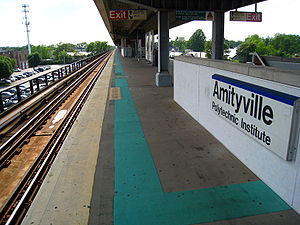
 The southern side of the island platform at the Amityville LIRR station. | ||||||||||||||||
| General information | ||||||||||||||||
| Location | John Street between Sterling Place & Oak Street Amityville, New York | |||||||||||||||
| Coordinates | 40°40′49″N 73°25′14″W / 40.680263°N 73.420472°W | |||||||||||||||
| Owned by | Long Island Rail Road | |||||||||||||||
| Line(s) | Montauk Branch | |||||||||||||||
| Platforms | 1 island platform | |||||||||||||||
| Tracks | 2 | |||||||||||||||
| Connections | ||||||||||||||||
| Construction | ||||||||||||||||
| Parking | Yes | |||||||||||||||
| Bicycle facilities | Yes | |||||||||||||||
| Accessible | Yes | |||||||||||||||
| Other information | ||||||||||||||||
| Fare zone | 9 | |||||||||||||||
| History | ||||||||||||||||
| Opened | 1868 (SSRRLI) | |||||||||||||||
| Rebuilt | 1889, 1964, 1968–1973 | |||||||||||||||
| Electrified | May 20, 1925 750 V (DC) third rail | |||||||||||||||
| Passengers | ||||||||||||||||
| 2012—2014 | 2,607[1] | |||||||||||||||
| Rank | 42 of 125 | |||||||||||||||
| Services | ||||||||||||||||
| ||||||||||||||||
| ||||||||||||||||
| ||||||||||||||||
Amityville is the westernmost station on the Babylon Branch of the Long Island Rail Road in Suffolk County. It is located on John Street in Amityville, New York, but the official description of its location is not as precise. The MTA describes the station as being located on John Street between Sunrise Highway (NY 27) and NY 27A west of NY 110. John Street is located between Sterling Place and West Oak Street (Old Sunrise Highway, NY 900D).
- ^ "2012-2014 LIRR Origin and Destination Report : Volume I: Travel Behavior Among All LIRR Passengers" (PDF). Metropolitan Transportation Authority. August 23, 2016. PDF pp. 15, 198. Archived (PDF) from the original on July 17, 2019. Retrieved March 29, 2020.
Data collection took place after the pretest determinations, starting in September 2012 and concluding in May 2014. .... 2012-2014 LIRR O[rigin and ]D[estination] COUNTS: WEEKDAY East/West Total By Station in Numerical Order

