This article needs additional citations for verification. (May 2021) |
| Arkabutla Lake | |
|---|---|
 Arkabutla Lake | |
| Location | DeSoto / Tate counties, Mississippi, United States |
| Coordinates | 34°45′42″N 090°07′20″W / 34.76167°N 90.12222°W |
| Type | reservoir |
| Primary inflows | Coldwater River |
| Primary outflows | Coldwater River |
| Basin countries | United States |
| Surface elevation | 226 ft (69 m)[1] |
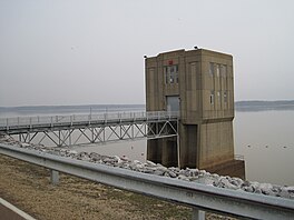
Arkabutla Lake is a reservoir on the Coldwater River in the U.S. state of Mississippi. It was created following the construction of the Arkabutla Dam in 1940 on the Coldwater River.
The dam is located on Arkabutla Dam Rd (Mississippi Highway 301/Mississippi Highway 304 Scenic) approximately 4 miles (6.4 km) north of the small community of Arkabutla. It is one of four Flood Damage Reduction reservoirs in northern Mississippi, the others being Sardis, Enid and Grenada lakes.
With an annual visitation exceeding 2 million people, Arkabutla Lake accommodates a wide variety of recreational interest and activities throughout the entire year. The Arkabutla Lake project includes 57,250 acres (231.7 km2) of land and water. The dam is 11,500 ft (3,500 m) long with an average height of 67 ft (20 m). There are 37,700 acres (153 km2) of land at the project which are open to the public for hunting.
On May 10, 2023, the United States Army Corps of Engineers warned residents to stay away from the reservoir as "potential breach conditions" had been found at the dam. The dam is undergoing emergency repairs. Though they stated that failure is not imminent, the National Weather Service forecast office in Memphis issued a flash flood watch through June 10 for areas of seven northwestern Mississippi counties located downstream of the dam.[2]
- ^ U.S. Geological Survey Geographic Names Information System: Arkabutla Lake
- ^ White, Robyn (2023-05-10). "Arkabutla Dam under emergency repair, Mississippi locals told to stay away". Newsweek. Retrieved 2023-05-11.


