Back اسينديلفت ARZ Assendelft CEB Assendelft Czech آسندلفت Persian Assendelft French Assendelft Frisian Assendelft Scots/Gaelic Assendelft Italian Assendelft Dutch Assendelft Polish
Assendelft | |
|---|---|
Town | |
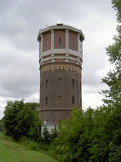
 The water tower of Assendelft | |
| Coordinates: 52°28′N 4°45′E / 52.467°N 4.750°E | |
| Country | Netherlands |
| Province | North Holland |
| Municipality | Zaanstad |
| Area | |
| • Total | 31.89 km2 (12.31 sq mi) |
| Elevation | −1.0 m (−3.3 ft) |
| Population (2021)[1] | |
| • Total | 24,230 |
| • Density | 760/km2 (2,000/sq mi) |
| Time zone | UTC+1 (CET) |
| • Summer (DST) | UTC+2 (CEST) |
| Postal code | 1566 & 1567[1] |
| Dialing code | 075 |
| Major roads | A8 N8 / N246 N203 |
Assendelft (Dutch pronunciation: [ˌɑsə(n)ˈdɛl(ə)ft]) is a town in the province of North Holland, Netherlands. It is a part of the municipality of Zaanstad. Assendelft was a separate municipality until 1974, when the municipality of Zaanstad was formed.[3] However, Assendelft didn't want to be part of Zaanstad and pled together with Krommenie to be part of a new municipality called Assendelft-Krommenie.[4] Zaanstad is part of the Amsterdam Agglomeration (GA).[5]
The North Sea Canal connects Assendelft with Amsterdam and Velsen, and it lies about 13 km northeast of Haarlem and about 15 km south of Alkmaar.
- ^ a b c "Kerncijfers wijken en buurten 2021". Central Bureau of Statistics. Retrieved 2 May 2022.
two entries
- ^ "Postcodetool for 1566AA". Actueel Hoogtebestand Nederland (in Dutch). Het Waterschapshuis. Retrieved 2 May 2022.
- ^ Ad van der Meer and Onno Boonstra, Repertorium van Nederlandse gemeenten, KNAW, 2011.
- ^ "Assendelft [ZaanWiki]". www.zaanwiki.nl. Retrieved 2021-05-04.
- ^ "Amsterdam (GA)". CBS. 2014.
Grootstedelijke Agglomeratie Amsterdam


