Badda
বাড্ডা | |
|---|---|
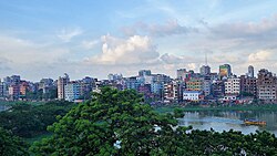
 South Badda overlooking Gulshan lake (2017) | |
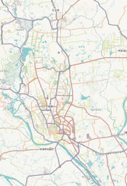
 Expandable map of vicinity of Badda Thana | |
| Coordinates: 23°46.3′N 90°25.6′E / 23.7717°N 90.4267°E | |
| Country | |
| Division | Dhaka Division |
| District | Dhaka District |
| Area | |
| • Total | 36.84 km2 (14.22 sq mi) |
| Elevation | 23 m (75 ft) |
| Population (2022) | |
| • Total | 375,598 |
| Time zone | UTC+6 (BST) |
| Notable sport teams | Badda Jagoroni Sangsad |
Badda (Bengali: বাড্ডা) is a thana (police jurisdiction) and township[2] in Dhaka District in the division of Dhaka, Bangladesh. Parts of the thana are under the administrative jurisdiction of Dhaka North City Corporation ward 21, and in part, ward 17, while the rest encompasses parts of the unions of Beraid, Badda,[3] Bhatara, and Satarkul in Tejgaon Development Circle.[4][5][6]
- ^ "Geographic coordinates of Dhaka, Bangladesh". DATEANDTIME.INFO. Retrieved 7 July 2016.
- ^ Cite error: The named reference
:0was invoked but never defined (see the help page). - ^ "Extortionists on the prowl in Badda". 29 April 2024.
- ^ National Report (PDF). Population and Housing Census 2022. Vol. 1. Dhaka: Bangladesh Bureau of Statistics. November 2023. p. 386. ISBN 978-9844752016.
- ^ Cite error: The named reference
Banglapediawas invoked but never defined (see the help page). - ^ ইউনিয়ন সমূহঃ তেজগাঁও উন্নয়ন সার্কেল [List of unions: Tejgaon Development Circle]. Bangladesh National Portal (in Bengali). Retrieved 10 May 2024.


