| Bald Eagle Mountain | |
|---|---|
 A Scimitar glider ridge soaring on Bald Eagle Mountain near Lock Haven, Pennsylvania | |
| Highest point | |
| Elevation | 2,112 ft (644 m) |
| Coordinates | 41°07′36″N 77°21′04″W / 41.12667°N 77.35111°W |
| Geography | |
| Location | Pennsylvania, U.S. |
| Parent range | Appalachian Mountains |
| Topo map | USGS Jersey Shore (PA) Quadrangle |
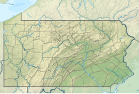
Bald Eagle Mountain – once known locally as Muncy Mountain[1] – is a stratigraphic ridge in the Ridge-and-Valley Appalachians of central Pennsylvania, United States, running east of the Allegheny Front and northwest of Mount Nittany. It lies along the southeast side of Bald Eagle Creek and south of the West Branch Susquehanna River, and is the westernmost ridge in its section of the Ridge-and-Valley Appalachians. The ridge line separates the West Branch Susquehanna Valley from the Nippenose and White Deer Hole valleys, and Bald Eagle Valley from Nittany Valley.
Bald Eagle Mountain lies in the central portion of Centre County, the southern portion of Clinton County, and the southern portion of Lycoming County, and the ridge line forms part of the border between Blair County and Huntingdon County. It runs from the water gap formed with Brush Mountain by the Little Juniata River at Tyrone, to the bend in the West Branch Susquehanna River just east of Williamsport, a distance of approximately 60 miles (97 km).
The Julian and Unionville Pikes are paved roads that cross the ridge near State College, along with U.S. Route 322 and Interstate 99 which pass through the now enlarged wind gap known as "Skytop".[2] Most other major road crossings are through water gaps, including Interstate 80 which passes through Curtin Gap east of Milesburg. Other water gaps in the ridge are formed by Spring Creek on the south edge of Milesburg and by Fishing Creek at Mill Hall (where U.S. Route 220 crosses). U.S. Route 15 crosses through a wind gap south of Williamsport near Bald Eagle Mountain's eastern end.
Bald Eagle Ridge is popular with soaring birds and glider pilots ridge soaring along its slopes. This ridge is part of a chain of ridges that stretch southwest to Tennessee. It is one of the best sites in the eastern United States for viewing the migration of the golden eagle.[3] The Ridge Soaring Gliderport lies at the foot of this ridge between Julian and Unionville.
A mature oak and hickory forest covers Bald Eagle Mountain.[4]
- ^ Trego, C.B. (1843). A Geography of Pennsylvania. Philadelphia: Edward C. Biddle. p. 255.
- ^ Gold, David P. & Doden, Arnold G. "Geological Report on the Skytop Road Cuts". Geosciences: Feature Article. Pennsylvania State University College of Earth and Mineral Sciences. Retrieved 2008-01-26.
- ^ "The Conservation Fund". Archived from the original on November 20, 2008. Retrieved 2009-04-12.
- ^ "Pennsylvania State Parks - Bald Eagle - PA DCNR". Archived from the original on 12 January 2008. Retrieved 2008-01-26.

