Back بانتام (كونيتيكت) Arabic بانتام ARZ Bantam (lungsod) CEB Bantam (Connecticut) Spanish Bantam (Connecticut) French Bantam (Connecticut) Italian Bantam (Connecticut) LLD ब्यान्टेम, कनेक्टिकट NEW Bantam (Connecticut) Dutch Bantam (Connecticut) Portuguese
Bantam, Connecticut | |
|---|---|
| Borough of Bantam | |
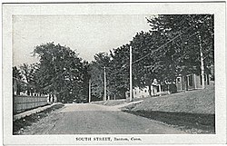
 South Street, about 1910 (postcard picture) | |
 Location in Litchfield County, Connecticut | |
| Coordinates: 41°43′24″N 73°14′26″W / 41.72333°N 73.24056°W | |
| Country | |
| U.S. state | |
| County | Litchfield |
| Region | Northwest Hills |
| Town | Litchfield |
| Area | |
| • Total | 1.01 sq mi (2.62 km2) |
| • Land | 1.01 sq mi (2.62 km2) |
| • Water | 0.00 sq mi (0.00 km2) |
| Elevation | 922 ft (281 m) |
| Population (2020) | |
| • Total | 720 |
| • Density | 719.80/sq mi (277.82/km2) |
| Time zone | UTC-5 (Eastern (EST)) |
| • Summer (DST) | UTC-4 (EDT) |
| ZIP code | 06750 |
| Area code | 860 |
| FIPS code | 09-02690 |
| GNIS feature ID | 0205245 |
| Website | bantamct |
Bantam is a borough in Litchfield County, Connecticut, United States. The population was 720 at the 2020 census. It is part of the town of Litchfield.
On July 10, 1989, many of the buildings in Bantam were heavily damaged by a tornado that ripped through Litchfield and New Haven Counties. The storm also caused considerable damage to the Litchfield County town of Thomaston, and to the New Haven County towns of Waterbury, Hamden and North Haven.
- ^ "2019 U.S. Gazetteer Files". United States Census Bureau. Retrieved July 2, 2020.