Back Barrowford (lungsod) CEB Barrowford Spanish Barrowford Basque Barrowford Italian Barrowford LLD Barrowford Dutch Barrowford Polish Barrowford Swedish Barrowford Turkish
| Barrowford | |
|---|---|
 Gisburn Road (1992) | |
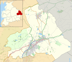
Location within Lancashire | |
| Population | 6,171 (2011) |
| OS grid reference | SD855395 |
| Civil parish |
|
| District | |
| Shire county | |
| Region | |
| Country | England |
| Sovereign state | United Kingdom |
| Post town | NELSON |
| Postcode district | BB9 |
| Dialling code | 01282 |
| Police | Lancashire |
| Fire | Lancashire |
| Ambulance | North West |
| UK Parliament | |
Barrowford (/ˌbæroʊˈfɔːrd/) is a village and civil parish in the Pendle district of Lancashire, England, north of Nelson,[1] near the Forest of Bowland Area of Outstanding Natural Beauty.[2][3]
Barrowford is on the Marsden–Gisburn–Long Preston turnpike. One of the original toll houses can still be seen at the junction with the road to Colne. The toll house was restored in the 1980s and is owned by the trust which operates nearby Pendle Heritage Centre. Barrowford is about half a mile from the Leeds and Liverpool Canal, and a set of seven locks leads to the highest section of the canal between Barrowford and Barnoldswick.
About a mile on from the locks heading towards Leeds is Foulridge Tunnel known locally as the "Mile Tunnel". The packhorse bridge near Higherford Mill is the oldest in Barrowford, dating to the end of the 16th century. It formerly lay on the old main road to Gisburn, which was superseded by the Turnpike road built in 1804.
The modern Anglican church (St Thomas') was built to replace the original church of 1839, which burnt down in 1964.
The village has two rivers: Pendle Water, which flows through it, and Colne Water, which joins Pendle Water behind the site of the now demolished Samuel Holden cotton mill and flows down from the moors above Colne.
The first residential home for the deaf in Lancashire was established at Barrowford in 1929.[4]
- ^ UK Census (2011). "Local Area Report – Barrowford Parish (1170215067)". Nomis. Office for National Statistics. Retrieved 8 February 2018.
- ^ "Gateway towns, Barrowford". Forest of Bowland. Retrieved 26 July 2022.
- ^ "Gateway towns, Barrowford". Visit Pendle. Retrieved 26 July 2022.
- ^ "Gateway towns, Barrowford". Forest of Bowland. Retrieved 26 July 2022.

