Back Bathurst Regional CEB Bathurst Region German Conseil de la région de Bathurst French Municipalità di Bathurst Italian Bathurst Regional Council Dutch Region Bathurst Polish Bathurst Regional Swedish
| Bathurst Regional Council New South Wales | |||||||||||||||
|---|---|---|---|---|---|---|---|---|---|---|---|---|---|---|---|
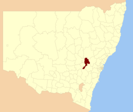
 Location in New South Wales | |||||||||||||||
 Bathurst Civic Centre | |||||||||||||||
| Coordinates | 33°25′S 149°34′E / 33.417°S 149.567°E | ||||||||||||||
| Population | 43,567 (LGA 2021)[1] | ||||||||||||||
| Established | 26 May 2004 | ||||||||||||||
| Area | 3,820 km2 (1,474.9 sq mi) | ||||||||||||||
| Mayor | Dr Jess Jennings | ||||||||||||||
| Council seat | Bathurst | ||||||||||||||
| Region | Central West | ||||||||||||||
| State electorate(s) | Bathurst | ||||||||||||||
| Federal division(s) | Calare | ||||||||||||||
 | |||||||||||||||
| Website | Bathurst Regional Council | ||||||||||||||
| |||||||||||||||
Bathurst Regional Council is a local government area in the Central West region of New South Wales, Australia. The area is located adjacent to the Great Western Highway, Mid-Western Highway, Mitchell Highway and the Main Western railway line. At the 2021 census, the Bathurst Region had a population of 43,567.[3]
The administrative centre of the area is located in the city of Bathurst, approximately 200 kilometres (120 mi) west of Sydney.
The mayor of Bathurst is Cr. Dr Jess Jennings, Deputy Mayor being Cr. Benjamin Fry, both unaligned politicians.[4]

- ^ Australian Bureau of Statistics (28 June 2022). "Bathurst Regional (Local Government Area)". Australian Census 2021 QuickStats. Retrieved 28 June 2022.
- ^ "3218.0 – Regional Population Growth, Australia, 2017–18". Australian Bureau of Statistics. 27 March 2019. Retrieved 27 March 2019. Estimated resident population (ERP) at 30 June 2018.
- ^ Cite error: The named reference
Census2016was invoked but never defined (see the help page). - ^ Therese, Ryan (15 January 2021). "Contact Bathurst Regional Councillors". Bathurst Regional Council. Archived from the original on 17 December 2015. Retrieved 15 January 2021.