Back Baw Baw National Park CEB Baw-Baw-Nationalpark German Parque nacional Baw Baw Spanish Parc national Baw Baw French Бау-Бау (национальный парк) Russian Baw Baw nationalpark Swedish
| Baw Baw National Park Victoria | |
|---|---|
 | |
Location of the Baw Baw National Park in Victoria | |
 | |
| Nearest town or city | Rawson |
| Coordinates | 37°45′50″S 146°13′23″E / 37.76389°S 146.22306°E |
| Established | April 1979[1] |
| Area | 135.3 km2 (52.2 sq mi)[1] |
| Managing authorities | Parks Victoria |
| Website | Baw Baw National Park |
| See also | Protected areas of Victoria |
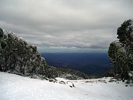
The Baw Baw National Park (/ˈbɔː ˈbɔː/) is a national park located on the boundary between the Victorian Alps and Gippsland regions of Victoria, Australia. The 13,530-hectare (33,400-acre) national park is situated approximately 120 kilometres (75 mi) east of Melbourne and 50 kilometres (31 mi) north of the Latrobe Valley. The park contains the forest covered Baw-Baw Plateau and surrounds the Mount Baw Baw Alpine Resort.
The Baw-Baw Plateau has a number of peaks, that includes Mount Baw Baw, Mount St Gwinear, Mount St Phillack, Mount Erica and Mount Whitelaw; all largely subalpine terrane outcrops of weathered granite boulders rising from the plateau, which is covered by a forest of snow-gums, punctuated by meadows. Mount St Phillack, a granite hill on the Baw-Baw plateau standing at 1,566 metres (5,138 ft) above sea level is the park's highest peak as the slightly higher Mt Baw Baw peak is part of the ski resort area.[2] The slopes of the plateau within the national park form the catchment areas for the Thomson River and the Thomson Reservoir, and the Tanjil and Tyers rivers.
