Back Beaverlodge ATJ Beaverlodge CEB Beaverlodge German Beaverlodge French Beaverlodge Italian Beaverlodge Kurdish Beaverlodge Dutch Beaverlodge (Alberta) Portuguese Биверлодж Russian Биверлоџ (Алберта) Serbian
Beaverlodge | |
|---|---|
Town | |
| Town of Beaverlodge | |
 Highway 43 passing through Beaverlodge | |
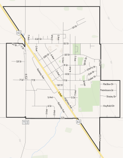
 Town boundaries | |
| Coordinates: 55°12′34″N 119°25′45″W / 55.20944°N 119.42917°W | |
| Country | Canada |
| Province | Alberta |
| Region | Northern Alberta |
| Planning region | Upper Peace |
| Municipal district | County of Grande Prairie No. 1 |
| Incorporated[1] | |
| • Village | July 31, 1929 |
| • Town | January 24, 1956 |
| Government | |
| • Mayor | Gary Rycroft |
| • Governing body | Beaverlodge Town Council |
| Area (2021)[2] | |
| • Land | 5.38 km2 (2.08 sq mi) |
| Elevation | 730 m (2,400 ft) |
| Population | |
| • Total | 2,271 |
| • Density | 421.9/km2 (1,093/sq mi) |
| Time zone | UTC−7 (MST) |
| • Summer (DST) | UTC−6 (MDT) |
| Highways | Highway 43 |
| Waterways | Beaverlodge River |
| Website | Official website |
Beaverlodge is a town in northern Alberta, Canada. It is located on Highway 43, 43 km (27 mi) west of Grande Prairie and 48 km (30 mi) east of the British Columbia border.
- ^ "Location and History Profile: Town of Beaverlodge" (PDF). Alberta Municipal Affairs. October 7, 2016. p. 43. Retrieved October 13, 2016.
- ^ a b Cite error: The named reference
2021censuswas invoked but never defined (see the help page). - ^ "Alberta Private Sewage Systems 2009 Standard of Practice Handbook: Appendix A.3 Alberta Design Data (A.3.A. Alberta Climate Design Data by Town)" (PDF) (PDF). Safety Codes Council. January 2012. pp. 212–215 (PDF pages 226–229). Archived from the original (PDF) on October 16, 2013. Retrieved October 8, 2013.
- ^ "Population and dwelling counts: Canada and population centres". Statistics Canada. February 9, 2022. Retrieved February 13, 2022.

