Back بحيره بيلاندور ARZ Bellandur Czech Bellandur-See German बेलान्दुर झील Hindi ಬೆಳ್ಳಂದೊರು ಕೆರೆ Kannada ਬੇਲੰਦੂਰ ਝੀਲ Punjabi بیلندور جھیل PNB பெள்ளந்தூர் ஏரி Tamil బెళ్లందూరు చెరువు Tegulu Bellandur Gölü Turkish
| Bellandur Lake | |
|---|---|
 | |
| Location | Bellandur, Bengaluru, Karnataka, India |
| Group | Varthur Lake Series |
| Coordinates | 12°56′3″N 77°39′46″E / 12.93417°N 77.66278°E |
| Type | Lake, aquatic eco-system |
| Part of | Koramangala-Challaghatta lake system |
| Primary inflows | Drain inlets - Ejlpura, Agara, Challaghatta, Iblur |
| Primary outflows | Varthur Lake |
| Catchment area | 148–287 km2 (57–111 sq mi) |
| Max. length | 3.6 km (2.2 mi) |
| Max. width | 1.4 km (0.87 mi) |
| Surface area | 812–919 acres (329–372 ha) |
| Average depth | 2 m (6 ft 7 in) |
| Max. depth | 9 m (30 ft) |
| Surface elevation | 870 m (2,850 ft) |
| Settlements | Begur, Agara, Yemalur, Varthur |
| References | [1][2][3][4] |
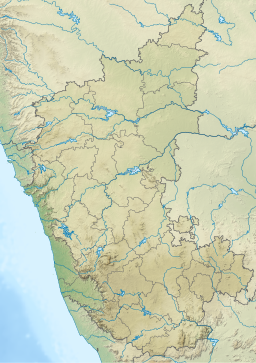
Bellandur Lake is located in the suburb of Bellandur in the southeast of the city of Bengaluru. It is the largest lake in the city.[8] It is a part of Bellandur drainage system that drains the southern and the south-eastern parts of the city. The lake is a receptor from three chains of lakes upstream, and has a catchment area of about 148 square kilometres (37,000 acres). Water from this lake flows further east to the Varthur Lake, from where it flows down the plateau and eventually into the Pinakani river basin.[9]
- ^ Cite error: The named reference
:ENVISTechnicalReport116was invoked but never defined (see the help page). - ^ Cite error: The named reference
:NewsArticle1was invoked but never defined (see the help page). - ^ Cite error: The named reference
:ENVISTechnicalReport95was invoked but never defined (see the help page). - ^ Cite error: The named reference
:RemoteSensingJournalwas invoked but never defined (see the help page). - ^ Ramachandra, T. V.; Mahapatra, Durga Madhab; S, Vinay; V, Sincy; K S, Asulabha; Bhat, Sudarshan P.; Aithal, Bharath H. (April 2017), Bellandur and Varthur Lakes Rejuvenation Blueprint, ENVIS Technical Report 116, Energy and Wetlands Research Group, Centre for Ecological Sciences, Indian Institute of Science, Bangalore, retrieved 5 October 2022 See section "Study Area" for Konena Agrahara Lake
- ^ "Lake series of Bangalore - Maps and Area - ENVIS (Govt of Karnataka)". India Water Portal. 16 June 2010. Retrieved 5 October 2022.
- ^ Isaac, Tanya (2020), Bacterial community analysis of seven polluted lakes in Bangalore, India (Thesis), Degree: BSc in Public Health, Tulane University, p. 10
- ^ "A 'thousand lakes' once fed now-parched Bengaluru".
- ^ "Bellandur Lake". www.RainwaterHarvesting.org. Retrieved 15 January 2018.


