Back Benuerivier Afrikaans نهر بنوي Arabic نهر بنوى ARZ Ríu Benue AST Бенуэ Bashkir Бенуэ Byelorussian Бэнуэ BE-X-OLD Бенуе (река) Bulgarian Benue BS Riu Benue Catalan
| Benue River | |
|---|---|
 | |
 | |
| Location | |
| Countries | |
| Physical characteristics | |
| Mouth | Niger River |
• location | Lokoja, Nigeria |
• coordinates | 07°45′12″N 06°45′24″E / 7.75333°N 6.75667°E |
| Length | 1,400 km (870 mi) |
| Basin size | 319,000 km2 (123,000 sq mi)[1] |
| Discharge | |
| • location | Lokoja, Nigeria (near mouth) |
| • average | 3,477 m3/s (122,800 cu ft/s)[1] |
| Basin features | |
| Tributaries | |
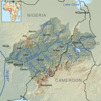
| • left | Mayo-Kébi, Gongola, Pai, Wase, Ankwe, Mada, Okwa |
| • right | Faro, Taraba, Donga, Katsina-Ala |
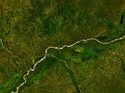
Benue River (French: la Bénoué), previously known as the Chadda River or Tchadda, is a major tributary of the Niger River.[2] The size of its catchment basin is 319,000 km2 (123,000 sq mi). Almost its entire length of approximately 1,400 kilometres (870 mi) is navigable during the summer months.[3][1] As a result, it is an important transportation route in the regions through which it flows.[4] The name Benue comes from Binuwe, meaning 'Mother of Waters’ in the Batta language.[5]


- ^ a b c "AGRICULTURAL ENGINEERING: An Introduction to Agricultural Engineering".
- ^ "Benue River | Nigeria, Cameroon, Chad | Britannica".
- ^ Babangida, Abdulkareem Mojeed, Mohammed (December 16, 2022). "SPECIAL REPORT: How poor infrastructure worsened flood disasters in states across Nigeria". Premium Times Nigeria. Retrieved July 4, 2023.
{{cite web}}: CS1 maint: multiple names: authors list (link) - ^ "Benue River". WorldAtlas. April 5, 2023. Retrieved July 3, 2023.
- ^ Njeuma, Martin Zachary (1969). THE RISE AND FALL OF FULANI RULE IN ADAMAWA 1809 - 1901 (PDF). University of London. p. 13.