Back Bexley (bahin nga lungsod) CEB بکسلی، نیو ساوت ولز Persian Bexley, New South Wales Romanian Бексли (Сидней) Russian Bexley, New South Wales Swedish بیکسلی، نیوساؤتھ ویلز Urdu
| Bexley Sydney, New South Wales | |||||||||||||||
|---|---|---|---|---|---|---|---|---|---|---|---|---|---|---|---|
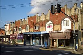
 Forest Road, Bexley | |||||||||||||||
 | |||||||||||||||
| Population | 19,646 (2021 census)[1] | ||||||||||||||
| Established | 1822 | ||||||||||||||
| Postcode(s) | 2207 | ||||||||||||||
| Elevation | 62 m (203 ft) | ||||||||||||||
| Location | 14 km (9 mi) south-west of Sydney CBD | ||||||||||||||
| LGA(s) | Bayside Council | ||||||||||||||
| State electorate(s) | |||||||||||||||
| Federal division(s) | Barton | ||||||||||||||
| |||||||||||||||
Bexley is a suburb in southern Sydney, in the state of New South Wales, Australia. Bexley is located 14 kilometres (8.7 mi) south-west of the Sydney central business district, in the local government area of the Bayside Council and is part of the St George area.
- ^ Australian Bureau of Statistics (28 June 2022). "Bexley (State suburb)". 2021 Census QuickStats. Retrieved 5 August 2024.