Back Bogan (rehiyon) CEB Bogan Shire German Comté de Bogan French Bogan Irish Contea di Bogan Italian Bogan Shire Council Dutch Bogan Shire Swedish
| Bogan Shire New South Wales | |||||||||||||||
|---|---|---|---|---|---|---|---|---|---|---|---|---|---|---|---|
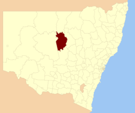
 Location in New South Wales | |||||||||||||||
| Coordinates | 31°34′S 147°12′E / 31.567°S 147.200°E | ||||||||||||||
| Population |
| ||||||||||||||
| • Density | 0.21/km2 (0.54/sq mi) | ||||||||||||||
| Established | 7 May 1906.[3] | ||||||||||||||
| Area | 14,611 km2 (5,641.3 sq mi) | ||||||||||||||
| Mayor | Glen Neill (Unaligned) | ||||||||||||||
| Council seat | Nyngan[4] | ||||||||||||||
| Region | Orana | ||||||||||||||
| State electorate(s) | Barwon | ||||||||||||||
| Federal division(s) | Parkes | ||||||||||||||
 | |||||||||||||||
| Website | Bogan Shire | ||||||||||||||
| |||||||||||||||
Bogan Shire is a local government area in the Orana region of New South Wales, Australia. The Shire is located adjacent to the Mitchell and Barrier highways and its only significant town is Nyngan.[5]
The Municipality of Nyngan was proclaimed on 17 February 1891 with Nyngan having a population of 1,355. Bogan Shire was proclaimed on 7 May 1906.[3] Bogan Shire absorbed the Municipality of Nyngan on 1 January 1972.[6]
The mayor of Bogan Shire Council is Cr. Glen Neill, who is unaligned with any political party.
- ^ Australian Bureau of Statistics (27 June 2017). "Bogan (A)". 2016 Census QuickStats. Retrieved 27 August 2020.
- ^ "3218.0 – Regional Population Growth, Australia, 2017–18". Australian Bureau of Statistics. 27 March 2019. Retrieved 27 March 2019. Estimated resident population (ERP) at 30 June 2018.
- ^ a b "Proclamation (121)". Government Gazette of the State of New South Wales. 7 March 1906. p. 1593. Retrieved 22 October 2018 – via National Library of Australia.
- ^ "Bogan Shire Council". Division of Local Government. Retrieved 3 December 2006.
- ^ "2016 Bogan (A), Census All persons QuickStats | Australian Bureau of Statistics". www.abs.gov.au. Retrieved 3 August 2022.
- ^ "Local Government Act 1919. Proclamation (149)". Government Gazette of the State of New South Wales. 24 December 1971. p. 4955. Retrieved 22 October 2018 – via National Library of Australia.