| Boulder River | |
|---|---|
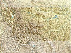
Location of the mouth of the southwestern Boulder River in Montana | |
| Location | |
| Country | United States |
| State | Montana |
| County | Jefferson |
| Physical characteristics | |
| Source | Continental Divide |
| • location | Boulder Mountains, Beaverhead-Deerlodge National Forest |
| • coordinates | 46°11′22″N 112°31′54″W / 46.18944°N 112.53167°W[1] |
| • elevation | 7,339 ft (2,237 m)[2] |
| Mouth | Jefferson River |
• location | Cardwell |
• coordinates | 45°52′01″N 111°56′44″W / 45.86694°N 111.94556°W[1] |
• elevation | 4,278 ft (1,304 m)[1] |
| Length | 77.3 mi (124.4 km)[3] |
| Discharge | |
| • location | Boulder |
| • average | 119 cu/ft. per sec.[4] |
The Boulder River is a 77-mile (124 km) tributary of the Jefferson River in southwestern Montana in the United States.[3]
It rises in the Rocky Mountains at the continental divide in the Beaverhead-Deerlodge National Forest in western Jefferson County. It flows east and southeast through the mountains past Boulder, then south to join the Jefferson near Cardwell.[5]
Game fish in the river include brook, brown, and rainbow trout, and mountain whitefish.[6] Brown trout are most prevalent in the last 2 miles (3 km), near the mouth, and the other three species are more prevalent in the reach upstream of the town of Boulder.[6] The lowermost 12 miles (19 km) of the river is affected by irrigation withdrawals, and the reach below the community of Basin is affected by seepage from old mines and tailings.[6]
- ^ a b c "Boulder River". Geographic Names Information System. United States Geological Survey. April 4, 1980. Retrieved January 13, 2013.
- ^ Source elevation derived from Google Earth search using GNIS source coordinates.
- ^ a b "Assessment Data for Montana, Boulder Watershed (8 Digit USGS Cataloging Unit)". U.S. Environmental Protection Agency. 2006. Archived from the original on February 17, 2013. Retrieved January 13, 2013.
- ^ USGS Surface-Water Annual Statistics for Montana
- ^ United States Geological Survey (USGS). "United States Geological Survey Topographic Map". TopoQuest. Retrieved January 23, 2013.
- ^ a b c "Detailed Waterbody Report: Boulder River". Montana Fish, Wildlife & Parks. Archived from the original on March 5, 2016. Retrieved January 23, 2013.

