Browns Bay | |
|---|---|
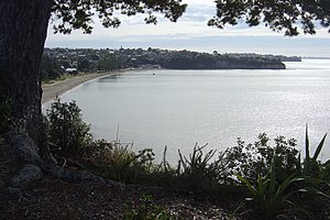
 Browns Bay and the beach from above. | |
 | |
| Coordinates: 36°42′58″S 174°44′31″E / 36.716°S 174.742°E | |
| Country | New Zealand |
| City | Auckland |
| Local authority | Auckland Council |
| Electoral ward | Albany ward |
| Local board | Hibiscus and Bays |
| Area | |
| • Land | 319 ha (788 acres) |
| Population (June 2024)[2] | |
| • Total | 10,760 |
| Torbay Heights | Waiake | (Hauraki Gulf) |
| Northcross |
|
(Hauraki Gulf) |
| Murrays Bay | Rothesay Bay | (Hauraki Gulf) |
Browns Bay is one of the most northernmost suburbs in the contiguous Auckland metropolitan area, located in the North Shore. Named after the Brown family who settled here in 1876, Browns Bay became a holiday destination in the late 19th century. The area gradually developed into a suburb of Auckland in the 1950s, and was the administrative centre for the East Coast Bays City from 1975 until it was disestablished in 1989. During the 1990s, the suburb became a hub for the South African New Zealander community.
- ^ Cite error: The named reference
Areawas invoked but never defined (see the help page). - ^ "Aotearoa Data Explorer". Statistics New Zealand. Retrieved 26 October 2024.
