Bruvik Municipality
Bruvik herad | |
|---|---|
 Bruvik on Osterøy island, seen from the top of Brøknipa | |
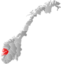
 Hordaland within Norway | |
 Bruvik within Hordaland | |
| Coordinates: 60°28′50″N 05°41′00″E / 60.48056°N 5.68333°E | |
| Country | Norway |
| County | Hordaland |
| District | Nordhordland |
| Established | 1 Jan 1870 |
| • Preceded by | Haus Municipality |
| Disestablished | 1 Jan 1964 |
| • Succeeded by | Vaksdal and Osterøy municipalities |
| Administrative centre | Bruvik |
| Government | |
| • Mayor (1960-1963) | Jan Hermann Hermansen |
| Area (upon dissolution) | |
| • Total | 391 km2 (151 sq mi) |
| Population (1963) | |
| • Total | 5,673 |
| • Density | 15/km2 (38/sq mi) |
| Demonym | Bruviking[1] |
| Time zone | UTC+01:00 (CET) |
| • Summer (DST) | UTC+02:00 (CEST) |
| ISO 3166 code | NO-1251[2] |
Bruvik is a former municipality in the old Hordaland county, Norway. The municipality existed from 1870 until its dissolution in 1964. At the time of its dissolution, the municipality covered 391 square kilometres (151 sq mi) on both sides of the Veafjorden, the innermost part of the Sørfjorden, including the southeastern part of the island of Osterøy. The administrative centre of the municipality was the village of Bruvik where Bruvik Church is located.[3]
- ^ "Navn på steder og personer: Innbyggjarnamn" (in Norwegian). Språkrådet.
- ^ Bolstad, Erik; Thorsnæs, Geir, eds. (26 January 2023). "Kommunenummer". Store norske leksikon (in Norwegian). Kunnskapsforlaget.
- ^ Store norske leksikon. "Bruvik" (in Norwegian). Retrieved 23 April 2014.

