This article relies largely or entirely on a single source. (November 2018) |
Bungeni | |
|---|---|
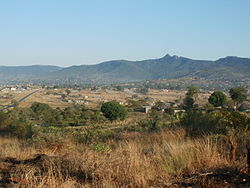
 A new village near Bungeni Big tree, Bungeni Village | |
| Coordinates: 23°12′22″S 30°13′26″E / 23.206°S 30.224°E | |
| Country | South Africa |
| Province | Limpopo |
| District | Vhembe |
| Municipality | Makhado |
| Area | |
| • Total | 10.94 km2 (4.22 sq mi) |
| Elevation | 700 m (2,300 ft) |
| Population (2011)[1] | |
| • Total | 23 000 |
| Racial makeup (2011) | |
| • Black African | 99.6% |
| • Coloured | 0.2% |
| • Indian/Asian | 0.1% |
| • White | 0.1% |
| • Other | 0.1% |
| First languages (2011) | |
| • Tsonga | 90.3% |
| • Venda | 7.3% |
| • Other | 2.5% |
| Time zone | UTC+2 (SAST) |
| Postal code (street) | n/a |
| PO box | n/a |
Bungeni is a large sprawling rural settlement situated on top of one of the foothills and tail end of the Soutpansberg mountain in Louis Trichardt, Limpopo Province, South Africa. The Levubu agricultural plantation, where avocado, bananas, litchis, macadamia nuts, peaches and mangoes are grown in abundance is just 3km away north of Bungeni village. It lies 35 km east of Makhado, with the R578 road (South Africa) passing through it. With more than 30 000 people, Bungeni is the largest Tsonga village in Makhado local municipality. In 1994 and in 2016, administrative control of this western portion of Gazankulu has been sub-divided in half and allocated to two Municipalities, first in 1994 to Makhado Local Municipality and in 2016, to the New Malamulele Municipality in the Vhembe district. As of April 2016, the Western portion, known as 'Bungeni West' by the locals, has remained in Makhado local municipality, while the eastern portion, known as 'Bungeni east', has been allocated to the new Malamulele Municipality.
- ^ a b c d "Main Place Bungeni". Census 2011.


