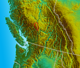
| Camelsfoot Range | |
|---|---|
 Southern ridges in the Camelsfoot Range near the Fraser River | |
| Highest point | |
| Peak | Red Mountain |
| Elevation | 2,445 m (8,022 ft) |
| Coordinates | 51°12′13.0″N 122°32′55.0″W / 51.203611°N 122.548611°W |
| Dimensions | |
| Area | 2,390 km2 (920 sq mi) |
| Geography | |
| Country | Canada |
| Province | British Columbia |
| Parent range | Chilcotin Ranges and Fraser Plateau |
The Camelsfoot Range is a sub-range of the Chilcotin Ranges subdivision of the Pacific Ranges of the Coast Mountains in British Columbia. The Fraser River forms its eastern boundary. The range is approximately 90 km at its maximum length and less than 30 km wide at its widest.[1]

