Back Капелу (Орта) CE Capelo (lungsod) CEB Capelo (Horta) German Capelo (Horta) Spanish Capelo (Horta) French Capelo (Horta) Portuguese Капелу (Орта) Russian Capelo (Azori) Slovenian Капелу (Орта) Tatar Capelo (Horta) ZH-MIN-NAN
Capelo | |
|---|---|
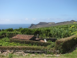
 The western landscape of Capelo, showing the Capelinhos Volcano, as it appeared (c.1990) | |
 Location of the civil parish of Capelo within the municipality of Horta | |
| Coordinates: 38°35′8″N 28°47′52″W / 38.58556°N 28.79778°W | |
| Country | |
| Auton. region | Azores |
| Island | Faial |
| Municipality | Horta |
| Established | Settlement: fl. 1550 Civil parish: c. 1600 |
| Area | |
| • Total | 26.64 km2 (10.29 sq mi) |
| Elevation | 263 m (863 ft) |
| Population (2011) | |
| • Total | 486 |
| • Density | 18/km2 (47/sq mi) |
| Time zone | UTC−01:00 (AZOT) |
| • Summer (DST) | UTC±00:00 (AZOST) |
| Postal code | 9900-302 |
| Area code | 292 |
| Patron | Santíssima Trindade |
Capelo is a freguesia ("civil parish") in the municipality of Horta on the island of Faial in the Azorean archipelago. The population in 2011 was 486,[1] in an area of 26.64 km2.[2] Capelo may be considered the westernmost settlement of Eurasia, if Fajã Grande, on Flores Island, is considered part of North America, for it sits on the North American Plate.
- ^ Instituto Nacional de Estatística
- ^ Eurostat Archived September 6, 2014, at the Wayback Machine