Back كاربونادو (واشنطن) Arabic كاربونادو ARZ Карбонадо Bulgarian Carbonado (Washington) Catalan Карбонадо (Вашингтон) CE Carbonado CEB Carbonado, Washington Welsh Carbonado (Washington) German Carbonado (Vaŝingtonio) Esperanto Carbonado (Washington) Spanish
Carbonado, Washington | |
|---|---|
 Welcome sign in Carbonado | |
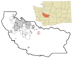
 Location of Carbonado, Washington | |
| Coordinates: 47°4′47″N 122°3′5″W / 47.07972°N 122.05139°W | |
| Country | United States |
| State | Washington |
| County | Pierce |
| Area | |
| • Total | 0.42 sq mi (1.08 km2) |
| • Land | 0.42 sq mi (1.08 km2) |
| • Water | 0.00 sq mi (0.00 km2) |
| Elevation | 1,191 ft (363 m) |
| Population | |
| • Total | 734 |
| • Density | 1,766.83/sq mi (681.61/km2) |
| Time zone | UTC-8 (Pacific (PST)) |
| • Summer (DST) | UTC-7 (PDT) |
| ZIP code | 98323 |
| Area code | 360 |
| FIPS code | 53-09970 |
| GNIS feature ID | 1517390[3] |
Carbonado (/kɑːrbəˈneɪdoʊ/)[4] is a town in Pierce County, Washington, United States. It is located near the Carbon River in the north of the county, approximately 50 miles (80 km) southeast of Seattle. Carbonado is the last town before entering Mount Rainier National Park and is also a popular spot for off-roading. The town also served as an important coal mining community in the late nineteenth and early twentieth centuries, when the town operated the largest coal mine in Pierce County. The population was 734 at the 2020 census.[2]
- ^ "2019 U.S. Gazetteer Files". United States Census Bureau. Retrieved August 7, 2020.
- ^ a b "2020 Census Redistricting Data (Public Law 94-171) Summary File". American FactFinder. United States Census Bureau. Retrieved May 16, 2022.
- ^ "US Board on Geographic Names". United States Geological Survey. October 25, 2007. Retrieved January 31, 2008.
- ^ Phillips, James W. (1971). Washington State Place Names. Seattle and London: University of Washington Press. p. 22. ISBN 0-295-95498-1.