Back مقاطعة كارلآيل (كنتاكي) Arabic Carlisle County, Kentucky BAR Карлайл (окръг, Кентъки) Bulgarian কার্লিসলে কাউন্টি, কেন্টাকি BPY Carlisle Gông (Kentucky) CDO Карлайл (гуо, Кентукки) CE Carlisle County CEB Carlisle County Czech Carlisle County, Kentucky Welsh Carlisle County German
Carlisle County | |
|---|---|
 Carlisle County Courthouse | |
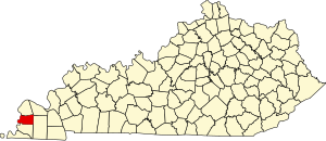
 Location within the U.S. state of Kentucky | |
 Kentucky's location within the U.S. | |
| Coordinates: 36°51′N 88°59′W / 36.85°N 88.98°W | |
| Country | |
| State | |
| Founded | 1886 |
| Named for | John G. Carlisle |
| Seat | Bardwell |
| Largest city | Bardwell |
| Area | |
| • Total | 199 sq mi (520 km2) |
| • Land | 189 sq mi (490 km2) |
| • Water | 9.5 sq mi (25 km2) 4.8% |
| Population (2020) | |
| • Total | 4,826 |
| • Estimate (2023) | 4,704 |
| • Density | 24/sq mi (9.4/km2) |
| Time zone | UTC−6 (Central) |
| • Summer (DST) | UTC−5 (CDT) |
| Congressional district | 1st |
| Website | carlislecounty |
Carlisle County is a county located in the U.S. state of Kentucky. As of the 2020 census, the population was 4,826, making it the fourth-least populous county in Kentucky. Its county seat is Bardwell.[1] The county was founded in 1886 and named for John Griffin Carlisle, a Speaker of the United States House of Representatives from Kentucky.[2] It remains a prohibition or dry county. Carlisle County is included in the Paducah, KY-IL, Metropolitan Statistical Area.
- ^ "Find a County". National Association of Counties. Archived from the original on May 31, 2011. Retrieved June 7, 2011.
- ^ The Register of the Kentucky State Historical Society, Volume 1. Kentucky State Historical Society. 1903. pp. 34.