Back كارينغتون Arabic كارينجتون ARZ کرینقتون، قوزئی داکوتا AZB Carrington Catalan Каррингтон (Къилбаседа Дакота) CE Carrington (kapital sa kondado) CEB Carrington (North Dakota) Danish Carrington (North Dakota) German Carrington (Dakota del Norte) Spanish Carrington (Ipar Dakota) Basque
Carrington, North Dakota | |
|---|---|
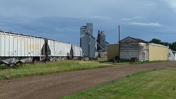
 Grain Elevator in Carrington | |
| Nickname: Central City | |
 Location of Carrington, North Dakota | |
| Coordinates: 47°27′05″N 99°07′26″W / 47.45139°N 99.12389°W | |
| Country | United States |
| State | North Dakota |
| County | Foster |
| Platted | 1882 |
| Founded | 1883 |
| Government | |
| • Mayor | Neil Fandrich |
| Area | |
| • Total | 2.37 sq mi (6.15 km2) |
| • Land | 2.37 sq mi (6.14 km2) |
| • Water | 0.00 sq mi (0.01 km2) |
| Elevation | 1,585 ft (483 m) |
| Population | |
| • Total | 2,080 |
| • Estimate (2022)[4] | 2,053 |
| • Density | 877.27/sq mi (338.73/km2) |
| Time zone | UTC-6 (Central (CST)) |
| • Summer (DST) | UTC-5 (CDT) |
| ZIP code | 58421 |
| Area code | 701 |
| FIPS code | 38-12340 |
| GNIS feature ID | 1035955[2] |
| Highways | US 52, US 281, ND 200 |
| Website | carringtonnd.com |
Carrington is a city in Foster County, North Dakota, United States. It is the county seat of Foster County. A part of Carrington Township and Wyard Township[5] The population was 2,080 at the 2020 census.[3] Carrington was founded in 1883.
Carrington is home to Dakota Growers Pasta Company, Inc.
- ^ "ArcGIS REST Services Directory". United States Census Bureau. Retrieved September 20, 2022.
- ^ a b U.S. Geological Survey Geographic Names Information System: Carrington, North Dakota
- ^ a b "Explore Census Data". United States Census Bureau. Retrieved October 20, 2023.
- ^ Cite error: The named reference
USCensusEst2022was invoked but never defined (see the help page). - ^ "Find a County". National Association of Counties. Archived from the original on May 31, 2011. Retrieved June 7, 2011.