Back كاس سيتي (ميشيغان) Arabic Cass City CEB Cass City, Michigan Welsh Cass City (Míchigan) Spanish Cass City (Michigan) Basque Cass City French Cass City Italian Касс Сити (Мичиган) Kazakh Касс Сити Kirghiz Cass City (Michigan) LLD
Cass City, Michigan | |
|---|---|
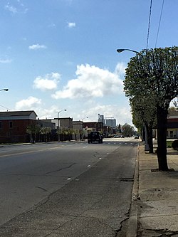
 Main Street (M-81), Cass City | |
| Motto: "each step in the right direction"[1] | |
 Location of Cass City, Michigan | |
| Coordinates: 43°35′58″N 83°10′35″W / 43.59944°N 83.17639°W | |
| Country | United States |
| State | Michigan |
| County | Tuscola |
| Township | Elkland |
| Named for | Cass River |
| Area | |
| • Total | 1.77 sq mi (4.58 km2) |
| • Land | 1.76 sq mi (4.57 km2) |
| • Water | 0.01 sq mi (0.01 km2) |
| Elevation | 745 ft (227 m) |
| Population (2020) | |
| • Total | 2,494 |
| • Density | 1,413.03/sq mi (545.69/km2) |
| Time zone | UTC-5 (Eastern (EST)) |
| • Summer (DST) | UTC-4 (EDT) |
| ZIP code | 48726 |
| Area code | 989 |
| FIPS code | 26-13880[3] |
| GNIS feature ID | 0622846[4] |
| Website | Village of Cass City, Michigan |
Cass City is a village in Elkland Township, Tuscola County in the Flint/Tri-Cities area of the U.S. state of Michigan. The population was 2,428 at the 2010 U.S. Census and 2,643 at the 2000 U.S. Census (a decrease of about 8%). It is located along M-81 approximately four miles (6.4 km) west of that highway's intersection with M-53. Cass City is surrounded by several communities including Colwood, Deford, Elmwood and Ellington.
- ^ "Village of Cass City, Michigan". Village of Cass City, Michigan. Retrieved August 25, 2012.
- ^ "2020 U.S. Gazetteer Files". United States Census Bureau. Retrieved May 21, 2022.
- ^ "U.S. Census website". United States Census Bureau. Retrieved January 31, 2008.
- ^ "US Board on Geographic Names". United States Geological Survey. October 25, 2007. Retrieved January 31, 2008.