| Castlereagh Sydney, New South Wales | |||||||||||||||
|---|---|---|---|---|---|---|---|---|---|---|---|---|---|---|---|
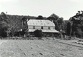
 Hadley Park, c. 1810 | |||||||||||||||
 | |||||||||||||||
| Coordinates | 33°40′19″S 150°40′42″E / 33.67194°S 150.67833°E | ||||||||||||||
| Population | 1,248 (2021 census)[1] | ||||||||||||||
| Established | 1810 | ||||||||||||||
| Postcode(s) | 2749[2] | ||||||||||||||
| Elevation | 31 m (102 ft) | ||||||||||||||
| Location | 67 km (42 mi) north-west of Sydney CBD | ||||||||||||||
| LGA(s) | City of Penrith | ||||||||||||||
| State electorate(s) | |||||||||||||||
| Federal division(s) | Lindsay | ||||||||||||||
| |||||||||||||||
Castlereagh is a suburb of Sydney, in the state of New South Wales, Australia. Castlereagh is 67 kilometres (42 mi) north-west of the Sydney central business district, in the local government area of the City of Penrith and is part of the Greater Western Sydney region.
- ^ Australian Bureau of Statistics (28 June 2022). "Castlereagh (State Suburb)". 2021 Census QuickStats. Retrieved 8 August 2024.
- ^ Castlereagh Postcode Australia Post

