Back Sederberg (berg) Afrikaans سيدربيرج ARZ Седэрберг Byelorussian Cederberg (kabukiran) CEB سێدەربێرگ CKB Cederberg Czech Zederberge German Réserve naturelle du Cederberg French セダルバーグ山脈 Japanese Cederbergfjellene NB
This article has multiple issues. Please help improve it or discuss these issues on the talk page. (Learn how and when to remove these template messages)
|
| Cederberg Wilderness Area | |
|---|---|
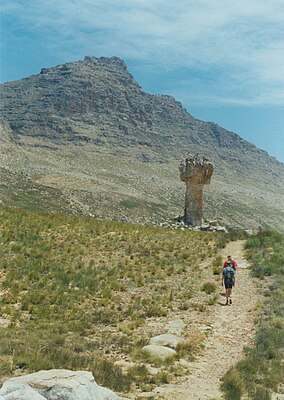
 Sneeuberg, the highest peak in the Cederberg, with the Maltese Cross in the foreground. | |
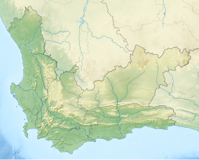
| Location | West Coast, Western Cape, South Africa |
| Nearest city | Clanwilliam |
| Coordinates | 32°20′S 19°5′E / 32.333°S 19.083°E |
| Area | 710 km2 (270 sq mi) |
| Established | 1973 |
| Governing body | CapeNature |
| World Heritage site | 2004 (Cape Floral Region Protected Areas) |
| www | |
| Part of | Cape Floral Region Protected Areas |
| Criteria | Natural: ix, x |
| Reference | 1007-002 |
| Inscription | 2004 (28th Session) |
| Extensions | 2015 |
The Cederberg mountains are located near Clanwilliam, approximately 300 km north of Cape Town, South Africa at about 32°30′S 19°0′E / 32.500°S 19.000°E. The mountain range is named after the endangered Clanwilliam cedar (Widdringtonia cedarbergensis), which is a tree endemic to the area. The mountains are noted for dramatic rock formations and San rock art. The Cederberg Wilderness Area is administered by CapeNature.
Cederberg is now the generally accepted spelling for the area, which combines the English (Cedarberg) and Afrikaans (Sederberg) variants.
