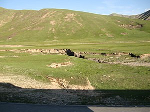
| Central Tibetan Plateau alpine steppe | |
|---|---|
 Qinghai-Tibet Plateau, in the east of the ecoregion | |
 Ecoregion territory (in purple) | |
| Ecology | |
| Realm | Palearctic |
| Biome | Montane grasslands and shrublands |
| Geography | |
| Area | 629,626 km2 (243,100 sq mi) |
| Countries | China |
| Coordinates | 34°00′N 92°00′E / 34.000°N 92.000°E |
The Central Tibetan Plateau alpine steppe ecoregion (WWF ID: PA1002) covers the high alpine plateau that stretches over 1,600 kilometres (1,000 mi) across the Tibetan Plateau to Qinghai Lake in China. Because of the high altitude—much it over 5,000 metres (16,000 ft)—the region is a cold, arid desert that is only 20% covered with steppe and meadow vegetation. The area has been relatively free from human development due to the hostile climate and unsuitability for agriculture. The ecosystem is relatively intact, and supports herds of wild antelope, sheep, deer, and gazelles.[1][2]
- ^ "Central Tibetan Plateau alpine steppe". World Wildlife Federation (WWF). Retrieved December 28, 2019.
- ^ "Map of Ecoregions 2017". Resolve, using WWF data. Retrieved September 14, 2019.
