Back مقاطعة شارلوت (فلوريدا) Arabic Charlotte County, Florida BAR Шарлът (окръг, Флорида) Bulgarian চার্লট কাউন্টি, ফ্লোরিডা BPY Charlotte Gông (Florida) CDO Шарлотт (гуо, Флорида) CE Charlotte County (kondado sa Tinipong Bansa, Florida) CEB Charlotte County, Florida Welsh Charlotte County (Florida) German Kantono Charlotte (Florido) Esperanto
Charlotte County | |
|---|---|
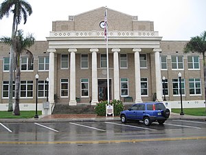
 The Old Charlotte County Courthouse at Punta Gorda in April 2010. | |
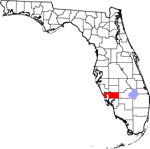
 Location within the U.S. state of Florida | |
 Florida's location within the U.S. | |
| Coordinates: 26°54′N 81°57′W / 26.9°N 81.95°W | |
| Country | |
| State | |
| Founded | April 23, 1921 |
| Named for | Charlotte Harbor |
| Seat | Punta Gorda |
| Largest community | Port Charlotte |
| Area | |
| • Total | 858 sq mi (2,220 km2) |
| • Land | 680 sq mi (1,800 km2) |
| • Water | 178 sq mi (460 km2) 20.7% |
| Population (2020) | |
| • Total | 186,847[1] |
| • Density | 275/sq mi (106/km2) |
| Time zone | UTC−5 (Eastern) |
| • Summer (DST) | UTC−4 (EDT) |
| Congressional district | 17th |
| Website | www |
Charlotte County is a U.S. county located in southwestern Florida. As of the 2020 census, the population was 186,847.[2] Its county seat is Punta Gorda.[3]
Charlotte County comprises the Punta Gorda, FL Metropolitan Statistical Area, which is included in the North Port-Bradenton, Florida Combined Statistical Area.
- ^ "U.S. Census Bureau QuickFacts: Charlotte County, Florida". Census.gov. Retrieved May 5, 2021.
- ^ "State & County QuickFacts". United States Census Bureau. Archived from the original on February 21, 2016. Retrieved June 13, 2014.
- ^ "Find a County". National Association of Counties. Archived from the original on May 31, 2011. Retrieved June 7, 2011.

