Back Chott el Jerid Afrikaans شط الجريد Arabic Cərid gölü Azerbaijani Шот-эль-Джэрыд Byelorussian Шот ел-Джерид Bulgarian Chott El Djerid Catalan Šot al-Džaríd Czech Шотт-эль-Джерид CV Chott el-Jerid Welsh Chott el Djerid German
| Chott el Djerid | |
|---|---|
 In summer Chott el Djerid is almost entirely dried up, as seen in this photo from May 2021. | |
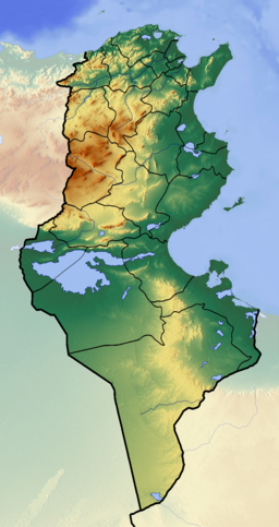
Chott al-Djarid in Tunisia | |
| Coordinates | 33°42′N 8°26′E / 33.7°N 8.43°E |
| Type | Salt lake, endorheic basin |
| Primary inflows | groundwater |
| Primary outflows | terminal Evaporation |
| Basin countries | Tunisia |
| Max. length | 250 km (160 mi) |
| Max. width | 20 km (12 mi) |
| Surface area | 7,000 km2 (2,700 sq mi) |
| Surface elevation | +10–25 m (33–82 ft) |
| Designated | 7 November 2007 |
| Reference no. | 1699[1] |
Chott el Djerid (Arabic: شط الجريد Šoṭṭ el-Jarīd) also spelled Sciott Gerid and Shott el Jerid,[2][3][4][5] is a chott, a large endorheic salt lake in southern Tunisia. The name can be translated from the Arabic into English as "Lagoon of the Land of Palms".[6]
- ^ "Chott El Jerid". Ramsar Sites Information Service. Retrieved 25 April 2018.
- ^ "Shaţţ al Jarīd: Tunisia". Geographical Names. Retrieved 2011-05-23.
- ^ "Sciott Gerid: Tunisia". Geographical Names. Retrieved 2011-05-23.
- ^ "Chott el Jerid: Tunisia". Geographical Names. Retrieved 2011-05-23.
- ^ "Shott el Jerid: Tunisia". Geographical Names. Retrieved 2011-05-23.
- ^ Scheffel, Richard L.; Wernet, Susan J., eds. (1980). Natural Wonders of the World. United States of America: Reader's Digest Association, Inc. pp. 125–126. ISBN 0-89577-087-3.
